Category:Sint Pietersberg
Jump to navigation
Jump to search
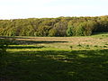
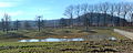
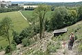
English: Mount Saint Peter (Sint Pietersberg in Dutch, Montagne Saint-Pierre in French) is a ridge running north to south between the valleys of the Geer to the west, and the Meuse to the east. It runs from Maastricht in the Netherlands, through Riemst in Belgian Limburg almost to the city of Liège in Belgium, thus defining the topography of this border area between Flanders, Wallonia and the Netherlands. It has been cut through in modern times, in order to link the Belgian Albert Canal to the Meuse.
Lëtzebuergesch: D'Montagne Saint-Pierre ( nl.: Sint Pietersberg) ass eng Kopp an der Belsch an an Holland, déi tëschent dem Dall vum Geer (am Nordwesten) an dem Dall vun der Meuse (am Südosten) läit. Vu Westen no Oste gesinn fänkt se no bei Léck un a si geet bis op Maastricht. Déi zwou héichste Plaze sinn déi eng bei Houtain-Saint Siméon um Flouer Fond des Vaches (164 m) an déi aner um Flouer Espinenette tëschent Lixhe a Bassenge (153 m). Déi zweet genannten ass méi bekannt, well do den Tunnel du Geer, och nach Tunnel vu Wonck genannt, derduerch geet.
hill in the Netherlands and Belgium .jpg) | |||||
| Upload media | |||||
| Instance of | |||||
|---|---|---|---|---|---|
| Part of |
| ||||
| Named after | |||||
| Location |
| ||||
| Owned by | |||||
| Maintained by | |||||
| Elevation above sea level |
| ||||
| Different from | |||||
 | |||||
Subcategories
This category has the following 89 subcategories, out of 89 total.
A
- Animals on the Sint Pietersberg (12 F)
B
C
- Casino Slavante (13 F)
- Chalet Bergrust (Maastricht) (7 F)
D
- D'n Observant (32 F)
- De Tombe, Maastricht (21 F)
- Duivelsgrot (37 F)
E
- Eiland van Bèr (Maastricht) (17 F)
- ENCI-bos (33 F)
- ENCI-weide (22 F)
- Endpoint Pieterpad (9 F)
- Entrance Gangenstelsel Zonneberg (18 F)
- EPV (Sint Pieter) (9 F)
F
- Folding screen (Josua de Grave) (51 F)
- Fort Sint Pieter (103 F)
G
- Groeve de Schark (63 F)
- Groeve de Tombe (11 F)
- Groeve van der Zwaan (5 F)
- Grote Ingang (Sint-Pietersberg) (25 F)
- Grotwoning De Kluis (24 F)
- Grotwoning Greetje Blanckers (34 F)
H
K
- Kiekoet (Sint-Pietersberg) (19 F)
- Sint Pietersberg kunstbunker (49 F)
L
M
- Maps of Sint Pietersberg (13 F)
N
- Neven Schark (9 F)
O
- Observantenklooster (Maastricht) (15 F)
- Oog van Sint Pieter (8 F)
- Oppidum Caestert (4 F)
- Oude Marendalgroeve (8 F)
P
- Predikherengat (2 F)
R
S
- Sint-Antoniuskapel (Sint Pieter) (37 F)
- Sint-Rochuskapel (Maastricht) (17 F)
T
- Thier de Nivelle (47 F)
U
V
- Van Schaïktunnel (14 F)
- Verloren Vallei (37 F)
Z
Media in category "Sint Pietersberg"
The following 85 files are in this category, out of 85 total.
-
 20130504 Maastricht Sint-Pietersberg 01 Sloping meadows on westside of hill.JPG 3,264 × 2,448; 1.75 MB
-
 20130504 Maastricht Sint-Pietersberg 02 Sloping meadows on westside of hill.JPG 3,264 × 2,448; 1.88 MB
-
 20130504 Maastricht Sint-Pietersberg 03 Sloping meadows on westside of hill.JPG 3,264 × 2,448; 1,000 KB
-
 20130504 Maastricht Sint-Pietersberg 04 Sloping meadows on westside of hill.JPG 3,264 × 2,448; 1.9 MB
-
 20130504 Maastricht Sint-Pietersberg 05 Sloping meadows on westside of hill.JPG 3,264 × 2,448; 1.5 MB
-
 20130504 Maastricht Sint-Pietersberg 06 Sloping meadows on westside of hill.JPG 3,264 × 2,448; 1.49 MB
-
 20130504 Maastricht Sint-Pietersberg 07 walking path on southside of hill.JPG 2,448 × 3,264; 1.93 MB
-
 20130504 Maastricht Sint-Pietersberg 08 Sloping meadows on westside of hill.JPG 2,448 × 3,264; 1.89 MB
-
 20130504 Maastricht Sint-Pietersberg 09 Road sign.JPG 2,934 × 2,204; 918 KB
-
 20130504 Maastricht Sint-Pietersberg 11 Ploughed acres on plateau.JPG 3,264 × 2,448; 1.57 MB
-
 20130504 Maastricht Sint-Pietersberg 12 Ploughed acres on plateau..JPG 3,264 × 2,448; 1.86 MB
-
 20130504 Maastricht Sint-Pietersberg 17 View at the Meuse from Eastside of the hill.JPG 3,264 × 2,448; 1.13 MB
-
 20130504 Maastricht Sint-Pietersberg 19 Sloping meadow on Eastside of hill.JPG 3,264 × 2,448; 454 KB
-
 20130505 Plateau van Caestert 01.JPG 3,968 × 2,976; 2.56 MB
-
 20130505 Plateau van Caestert 02.JPG 3,968 × 2,976; 2.86 MB
-
 20130505 Plateau van Caestert 03.JPG 3,968 × 2,976; 2.96 MB
-
 20130505 Plateau van Caestert 04.JPG 3,968 × 2,976; 3.07 MB
-
 20130505 Plateau van Caestert 05.JPG 3,968 × 2,976; 2.87 MB
-
 20130505 Plateau van Caestert 06.JPG 3,968 × 2,976; 2.32 MB
-
 20130505 Plateau van Caestert 07.JPG 3,968 × 2,976; 2.8 MB
-
 20140526 Meuse river seen from Sint Pietersberg.JPG 3,968 × 2,976; 2.76 MB
-
 20150312 Maastricht; Meuse seen from Kennedybrug to the south 10.jpg 3,968 × 2,976; 2.4 MB
-
 20150312 Maastricht; Meuse seen from Kennedybrug to the south 11.jpg 3,968 × 2,648; 2.34 MB
-
 2016 Maastricht, St Pietersberg, oefenterrein schutterij.JPG 1,448 × 959; 558 KB
-
 2016 Maastricht, St Pietersberg, wegwijzer.JPG 1,116 × 1,654; 1.08 MB
-
 2016 Maastricht, St-Pietersberg, Luikerweg.jpg 2,400 × 1,800; 1.68 MB
-
 2017 Maastricht, Kleine Weerd 26.jpg 2,800 × 1,750; 2.28 MB
-
 2021 Maastricht, Louwberg (07).jpg 4,026 × 2,650; 3.74 MB
-
 2021 Maastricht, Louwberg (08).jpg 3,975 × 2,077; 3.08 MB
-
 2021 Maastricht, Louwberg (11).jpg 4,032 × 3,024; 4.7 MB
-
 2023 Limburgs Museum, zesslags kamerscherm (07).jpg 2,513 × 3,366; 2.13 MB
-
 2023 Limburgs Museum, zesslags kamerscherm (17).jpg 2,519 × 3,372; 1.97 MB
-
Afgraving van de Sint Pietersberg Weeknummer 59-22 - Open Beelden - 61783.ogv 3 min 16 s, 384 × 288; 14.08 MB
-
 Dactilorhyza dans le Thier à la Tombe.jpg 3,000 × 4,000; 4.75 MB
-
 Heugem, Hoge Weerd2.jpg 1,500 × 766; 385 KB
-
 Heugem, Hoge Weerd3.jpg 1,500 × 600; 383 KB
-
In het hart van de St. Pietersberg-522051.ogv 2 min 46 s, 768 × 576; 30.06 MB
-
 Kanne-Sint-Pietersberg (1).jpg 4,032 × 2,268; 2.52 MB
-
 Kanne-Sint-Pietersberg (2).jpg 6,256 × 2,224; 3.57 MB
-
 Knotwilgen in Maastricht.jpg 3,456 × 2,592; 3.98 MB
-
 Maastricht 2008 Sint Pieter.jpg 1,024 × 768; 351 KB
-
 Maastricht Enci Groeve De Lanaye Visé, België Sint Pietersberg 08 02 18 180000.jpeg 3,024 × 4,032; 4.43 MB
-
 Maastricht, Fort StPieter2014- 11.jpg 1,707 × 1,037; 381 KB
-
 Maastricht, Fort StPieter2014- 12.jpg 1,712 × 1,005; 370 KB
-
 Maastricht, Maas en St-Pietersberg (V d Heuvel, ca 1790).jpg 1,531 × 568; 508 KB
-
 Maastricht, Sint-Pietersberg (A Schaepkens).jpg 1,280 × 957; 572 KB
-
 Maastricht-Bladmineerder actief op de Sint-Pietersberg.jpg 2,268 × 4,032; 4.04 MB
-
 Maastricht-distel op de Sint-Pietersberg.jpg 4,032 × 2,268; 6.2 MB
-
 Maastricht-Entree Sint-Pietersberg Pruisstraat.jpg 4,032 × 2,268; 4.3 MB
-
 Maastricht-holle weg bij Ganzendries Sint-Pietersberg.jpg 4,032 × 2,268; 6.19 MB
-
 Maastricht-meetstation Sint-Pietersberg.jpg 4,032 × 2,268; 4.1 MB
-
 Maastricht-Poppelmondedal (9).jpg 6,400 × 2,192; 4.26 MB
-
 Maastricht-Willem Stipdonk Memorial Pieterpad 18 mei 2007 (1).jpg 4,032 × 2,268; 7.23 MB
-
 Maastricht-Willem Stipdonk Memorial Pieterpad 18 mei 2007 (2).jpg 4,032 × 2,268; 6.92 MB
-
 Montagne Saint Pierre.jpg 3,008 × 2,000; 2.89 MB
-
 Montagne Saint-Pierre et Écluse de Lanaye.jpg 3,008 × 2,000; 3.19 MB
-
 Montagne Saint-Pierre.jpg 2,048 × 1,153; 667 KB
-
 Natuurmonumenten Sint-Pietersberg.jpg 960 × 720; 74 KB
-
 Sin Pieter-voormalig traject van mergelgroeve Sint Pieter naar de Lage Kanaaldijk (1).jpg 4,032 × 2,268; 4.76 MB
-
 Sin Pieter-voormalig traject van mergelgroeve Sint Pieter naar de Lage Kanaaldijk (2).jpg 4,032 × 2,268; 6.84 MB
-
 Sin Pieter-voormalig traject van mergelgroeve Sint Pieter naar de Lage Kanaaldijk (3).jpg 4,032 × 2,268; 6.96 MB
-
 Sint Pieter-reinsteen met ster in holleweg bij Ganzendries (1).jpg 2,268 × 4,032; 4.02 MB
-
 Sint Pieter-reinsteen met ster in holleweg bij Ganzendries (2).jpg 4,032 × 2,268; 4.33 MB
-
 Sint Pieter-reinsteen met ster in holleweg bij Ganzendries (3).jpg 4,032 × 2,268; 5.61 MB
-
 Sint Pieter-reinsteen met ster in holleweg bij Ganzendries (4).jpg 2,268 × 4,032; 5.72 MB
-
 Sint Pieter-reinsteen met ster in holleweg bij Ganzendries (5).jpg 4,032 × 2,268; 5.55 MB
-
 Sint Pieter-reinsteen met ster in holleweg bij Ganzendries (6).jpg 4,032 × 2,268; 5.74 MB
-
 Sint-Pietersberg (xndr).jpg 1,728 × 1,152; 292 KB
-
 Sint-Pietersberg Natuurmonumenten.jpg 2,048 × 1,536; 941 KB
-
 Sint-Pietersberg.jpg 1,536 × 2,048; 425 KB
-
 SintPietersbergENCI011.jpg 2,048 × 1,536; 667 KB
-
 SintPietersbergPanorama002.jpg 2,047 × 849; 560 KB
-
 SintPietersbergWegLangsGroeve001.jpg 2,047 × 1,212; 601 KB
-
 SintPietersbergWegLangsGroeve004.jpg 2,047 × 1,210; 730 KB
-
 SintPietersbergWegLangsGroeve007.jpg 1,918 × 1,200; 689 KB
-
 Suppoost met uniformpet en aktetas loopt over een pad, Bestanddeelnr 900-2418.jpg 2,876 × 2,906; 1.46 MB
-
 Ternaaien-Vuursteenlagen in bergwand (1).jpg 2,268 × 4,032; 5.95 MB
-
 Ternaaien-Vuursteenlagen in bergwand (2).jpg 4,032 × 2,268; 6.02 MB
-
 Ternaaien-Vuursteenlagen in bergwand (3).jpg 4,032 × 2,268; 4.82 MB
-
 Ternaaien-Vuursteenlagen in bergwand (4).jpg 2,268 × 4,032; 5.82 MB
-
 Usine CBR depuis la Montagne Saint PIerre.jpg 3,008 × 2,000; 2.34 MB
-
-

-

-


.jpg)
.jpg)
.jpg)
.jpg)
.jpg)


.jpg)


.jpg)


.jpg)
.jpg)


.jpg)
.jpg)
.jpg)
.jpg)
.jpg)
.jpg)
.jpg)
.jpg)
.jpg)
.jpg)


.jpg)
.jpg)
.jpg)
.jpg)


.jpg)
.jpg)
.jpg)
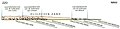
-Staringia_12-Schematisch_profiel_van_zuidzuidoost_naar_noordnoordwest.jpg)